Main files
- [nauru.pbf] - for osm2pgsql, Osmium, Osmosis, imposm, mkgmap, and others. This file was last modified -02 hours ago and contains all OSM data up to July 27 2024 07:12:00. File size: 209.89KB; MD5 sum: a7643ba202cff61e02651b622d650edd.
Additional Files
- [nauru.poly] - file that describes the extent of this region. About POLY format
- [nauru.geojson] - file that describes the extent of this region. About GeoJSON format
Prepared geodata of Nauru in the SHP format
You are getting:
- Fresh geo data from the Openstreetmap project in ESRI Shape format
- If necessary, we can provide data in the following formats: GeoPackage, GeoJSON, CSV, TAB
- Ready-made project for the QGIS 3 mapping program
- Styles for all layers
- 150+ icons
Sample of map


Nauru map layers
Amenity (areas) 14
Fields of layer:
- osm_id — ID in OSM base
- name — Local name
- name_en — Name in English
- religion — religion field value
- amenity — amenity field value
- landuse — landuse field value
- leisure — leisure field value
- sport — sport field value
- type — type field value
- way — Geometry
Amenity (points) 25
Fields of layer:
- osm_id — ID in OSM base
- name — Local name
- name_en — Name in English
- religion — religion field value
- amenity — amenity field value
- landuse — landuse field value
- leisure — leisure field value
- sport — sport field value
- type — type field value
- way — Geometry
Barriers (lines) 24
Fields of layer:
- osm_id — ID in OSM base
- barrier — barrier field value
- way — Geometry
Boundary (areas) 23
Fields of layer: 
- osm_id — ID in OSM base
- name — Local name
- name_en — Name in English
- admin_level - Grade of administrative level
- way — Geometry
Boundary (lines) 26
Fields of layer: 
- osm_id — ID in OSM base
- name — Local name
- name_en — Name in English
- admin_level - Grade of administrative level
- way — Geometry
Building 2459
Fields of layer:
- osm_id — ID in OSM base
- name — Local name
- name_en — Name in English
- building — building field value
- b_level — building:levels field value
- a_numb — addr:housenumber field value
- way — Geometry
Surfaces and land use 248
Fields of layer:
- osm_id — ID in OSM base
- name — Local name
- name_en — Name in English
- natural — Natural field value
- landuse — Landuse field value
- wood — Wood field is not null
- leisure — Leisure field value
- way — Geometry
Leisure (areas) 3
Fields of layer:
- osm_id — ID in OSM base
- name — Local name
- name_en — Name in English
- leisure — leisure field value
- way — Geometry
Leisure (points) 4
Fields of layer:
- osm_id — ID in OSM base
- name — Local name
- name_en — Name in English
- leisure — leisure field value
- way — Geometry
Natural (points) 79
Fields of layer:
- osm_id — ID in OSM base
- name — Local name
- natural — natural field value
- way — Geometry
Parking (areas) 1
Fields of layer: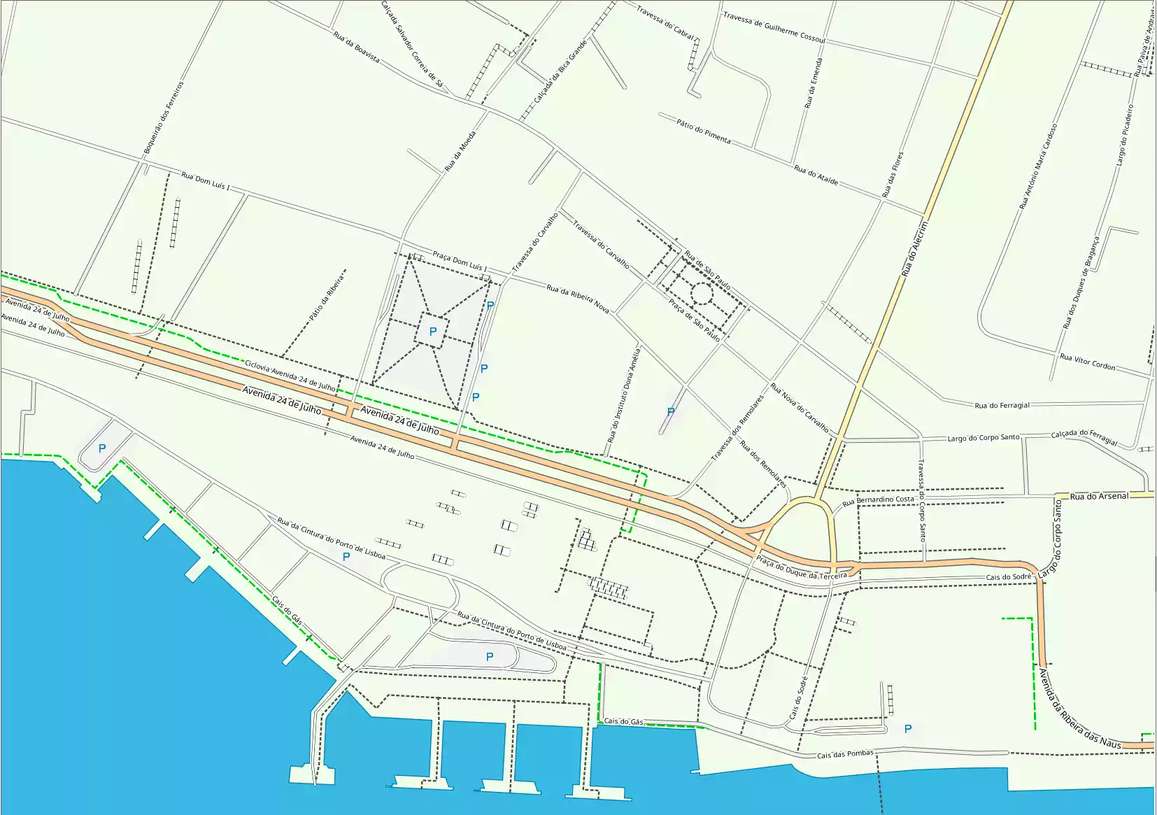
- osm_id — ID in OSM base
- name — Local name
- name_en — Name in English
- AMENITY — AMENITY field value
- way — Geometry
Parking (points) 1
Fields of layer:
- osm_id — ID in OSM base
- name — Local name
- name_en — Name in English
- AMENITY — AMENITY field value
- way — Geometry
Places (areas) 1
Fields of layer:
- osm_id — ID in OSM base
- name — Local name
- name_en — Name in English
- place — place field value
- official_s — official_status field value
- POPULATION — POPULATION field value
- way — Geometry
Places (points) 151
Fields of layer:
- osm_id — ID in OSM base
- name — Local name
- name_en — Name in English
- place — place field value
- official_s — official_status field value
- POPULATION — POPULATION field value
- is_capital — is_capital field value
- admin_level — Administrative grade value
- capital — capital field value
- way — Geometry
Power lines 4
Fields of layer:
- osm_id — ID in OSM base
- name — Local name
- POWER — POWER field value
- VOLTAGE — VOLTAGE field value
- way — Geometry
Power line towers 24
Fields of layer:
- osm_id — ID in OSM base
- name — Local name
- POWER — POWER field value
- VOLTAGE — VOLTAGE field value
- way — Geometry
Religion (areas) 3
Fields of layer:
- osm_id — ID in OSM base
- name — Local name
- name_en — Name in English
- religion — religion field value
- way — Geometry
Religion (points) 3
Fields of layer:
- osm_id — ID in OSM base
- name — Local name
- name_en — Name in English
- religion — religion field value
- way — Geometry
Roads 418
Fields of layer:
- osm_id — ID in OSM base
- name — Local name
- name_en — Name in English
- ref — ref field value
- HIGHWAY — HIGHWAY field value
- cycle — cycle field value
- horse — horse field value
- foot — foot field value
- lanes — lanes field value
- toll — toll field value
- width — width field value
- way — Geometry
Road infrastructure 1
Fields of layer:
- osm_id — ID in OSM base
- name — Local name
- name_en — Name in English
- HIGHWAY — HIGHWAY field value
- railway — railway field value
- way — Geometry
Shop (areas) 3
Fields of layer:
- osm_id — ID in OSM base
- name — Local name
- name_en — Name in English
- shop — shop field value
- way — Geometry
Shops (points) 7
Fields of layer:
- osm_id — ID in OSM base
- name — Local name
- name_en — Name in English
- shop — shop field value
- way — Geometry
Sport (areas) 7
Fields of layer:
- osm_id — ID in OSM base
- name — Local name
- name_en — Name in English
- sport — sport field value
- way — Geometry
Sport (points) 7
Fields of layer:
- osm_id — ID in OSM base
- name — Local name
- name_en — Name in English
- sport — sport field value
- way — Geometry
Tourism (areas) 3
Fields of layer:
- osm_id — ID in OSM base
- name — Local name
- name_en — Name in English
- TOURISM — TOURISM field value
- information — information field value
- historic — historic field value
- way — Geometry
Tourism (points) 27
Fields of layer:
- osm_id — ID in OSM base
- name — Local name
- name_en — Name in English
- TOURISM — TOURISM field value
- information — information field value
- historic — historic field value
- way — Geometry
Lakes, swamps and large rivers 18
Fields of layer:
- osm_id — ID in OSM base
- name — Local name
- name_en — Name in English
- natural — Natural field value
- landuse — Landuse field value
- water — Water field is not null
- waterway — Waterway field value
- way — Geometry
Coastline 1
Fields of layer:
- id — Local ID
Land border 1
Fields of layer:
- id — Local ID
Ocean border 1
Fields of layer:
- id — Local ID
Legend of map of Nauru and sample project


Statistics on objects in the Nauru
Boundary / Boundary (lines)
| Name | Type | OSM Tag | Count |
| Countries | lines | admin_level = '2' | 4 |
| Administrative level 4 | lines | admin_level = '4' | 8 |
| Administrative level 6 | lines | admin_level = '6' | 14 |
Boundary / Boundary (Polygons)
| Name | Type | OSM Tag | Count |
| Countries | polygons | admin_level = '2' | 1 |
| Administrative level 4 | polygons | admin_level = '4' | 8 |
| Administrative level 6 | polygons | admin_level = '6' | 14 |
| Places | polygons | place = 'city' / place = 'town' / place = 'village' / place = 'hamlet' / place = 'locality' / place = 'suburb' / place = 'island' / place = 'farm' / place = 'isolated_dwelling' | 1 |
Boundary of settlements and territories
| Name | Type | OSM Tag | Count |
| Island | polygons | place = 'island' | 1 |
Building (points)
| Name | Type | OSM Tag | Count |
![.$row2[6].](/img/Building-points.webp)
Building (polygons)
| Name | Type | OSM Tag | Count |
| Building | polygons | building is not '' | 2459 |
| Dominants | polygons | building = 'church' / building = 'government' / building = 'cathedral' / building = 'public' / building = 'hospital' / building = 'train_station' / building = 'chapel' / building = 'college' / building = 'university' | 3 |
Facilities and services / Facilities
| Name | Type | OSM Tag | Count |
| police | points | amenity = 'police' | 1 |
| post office | points | amenity = 'post_office' | 1 |
| embassy | points | amenity = 'embassy' / office = 'diplomatic' | 1 |
| restaurant | points | amenity = 'restaurant' | 7 |
| bank | points | amenity = 'bank' | 1 |
| atm | points | amenity = 'atm' | 1 |
Facilities and Services / Places of Worship
| Name | Type | OSM Tag | Count |
Facilities and services / Recreation
| Name | Type | OSM Tag | Count |
| slipway | points | leisure = 'slipway' | 1 |
Facilities and Services / Shops and Services
| Name | Type | OSM Tag | Count |
| supermarket, general | points | shop = 'supermarket' / shop = 'general' | 2 |
| convenience | points | shop = 'convenience' | 1 |
| mobile phone | points | shop = 'mobile_phone' | 1 |
Facilities and services / Sports facilities
| Name | Type | OSM Tag | Count |
Facilities and services / Tourist facilities
| Name | Type | OSM Tag | Count |
| attraction | points/polygons | tourism = 'attraction' | 7 |
| guest house | points/polygons | tourism = 'guest_house' | 1 |
| hotel | points | tourism = 'hotel' | 2 |
| museum | points/polygons | tourism = 'museum' | 1 |
| viewpoint | points | tourism = 'viewpoint' | 11 |
| monument | points | historic = 'monument' | 2 |
Ground surface
| Name | Type | OSM Tag | Count |
| Coastlines | lines | 1 | |
| Water surface | polygons | 1 | |
| Land boundaries | polygons | 1 |
Hydrography / Lakes, large rivers, swamps
| Name | Type | OSM Tag | Count |
| Lakes and large rivers | polygons | natural = 'water' / waterway = 'riverbank' | 18 |
| water' and water not | polygons | natural = 'water' + water is not 'river' + water is not 'reservoir' | 11 |
Hydrography / Rivers, streams, canals
| Name | Type | OSM Tag | Count |
![.$row2[6].](/img/Streems.webp)
Infrastructure / Fences
| Name | Type | OSM Tag | Count |
| Fence | lines | barrier = 'fence' | 10 |
| Wall | lines | barrier = 'wall' | 14 |
Infrastructure / Man-made objects
| Name | Type | OSM Tag | Count |
Infrastructure / Power lines
| Name | Type | OSM Tag | Count |
| Power lines | lines | power is not '' | 4 |
Infrastructure / Towers Power lines
| Name | Type | OSM Tag | Count |
| Towers Power lines | points | power is not '' | 24 |
Natural objects
| Name | Type | OSM Tag | Count |
| Peak | points | natural = 'peak' | 5 |
| Tree | points | natural = 'tree' | 74 |
Settlements
| Name | Type | OSM Tag | Count |
| Village | points | place = 'village' | 15 |
| Hamlet | points | place = 'hamlet' | 2 |
| Hamlet | points | place = 'locality' | 134 |
Surfaces and land use
| Name | Type | OSM Tag | Count |
| Brownfield | polygons | landuse = 'brownfield' | 2 |
| Cemetery | polygons | landuse = 'cemetery' | 1 |
| Commercial | polygons | landuse = 'commercial' | 1 |
| Construction | polygons | landuse = 'construction' | 1 |
| Forest | polygons | landuse = 'forest' / landuse = 'natural' | 16 |
| Grass | polygons | landuse = 'grass' | 7 |
| Industrial | polygons | landuse = 'industrial' | 6 |
| Meadow | polygons | landuse = 'meadow' | 7 |
| Quarry | polygons | landuse = 'quarry' | 7 |
| Residential | polygons | landuse = 'residential' | 30 |
| Beach | polygons | natural = 'beach' | 8 |
| Fell | polygons | natural = 'fell' | 1 |
| Grassland | polygons | natural = 'grassland' | 1 |
| Heath | polygons | natural = 'heath' | 3 |
| Sand | polygons | natural = 'sand' | 1 |
| Scrub | polygons | natural = 'scrub' | 40 |
Territories of services and services / Facilities
| Name | Type | OSM Tag | Count |
| Amenity | polygons | amenity is not '' | 16 |
Territories of services and services / Recreation
| Name | Type | OSM Tag | Count |
| Leisure | polygons | leisure is not '' | 25 |
Territories of services and services / Religious objects
| Name | Type | OSM Tag | Count |
| Place of worship | polygons | amenity = 'place_of_worship' | 3 |
| Place of worship | polygons | amenity = 'place_of_worship' | 3 |
Territories of services and services / Shops and services
| Name | Type | OSM Tag | Count |
| Shop | polygons | shop is not '' | 4 |
Territories of services and services / Sports facilities
| Name | Type | OSM Tag | Count |
| Sport | polygons | sport is not '' | 10 |
Territories of services and services / Tourist objects
| Name | Type | OSM Tag | Count |
| Tourism | polygons | tourism is not '' | 3 |
Transport / Parking
| Name | Type | OSM Tag | Count |
| parking | polygons | amenity = 'parking' | 1 |
Transport / Public transport routes
| Name | Type | OSM Tag | Count |
![.$row2[6].](/img/Routes.webp)
Transport / Railway platforms
| Name | Type | OSM Tag | Count |
![.$row2[6].](/img/Platforms.webp)
Transport / Railways
| Name | Type | OSM Tag | Count |
![.$row2[6].](/img/Railways.webp)
Transport / Road
| Name | Type | OSM Tag | Count |
| Primary | lines | highway = 'primary' / highway = 'primary_link' | 4 |
| Tertiary | lines | highway = 'tertiary' / highway = 'tertiary_link' | 2 |
| Unclassified | lines | highway = 'unclassified' | 22 |
| Residential | lines | highway = 'residential' | 135 |
| Service | lines | highway = 'service' | 192 |
| Footway | lines | highway = 'footway' / highway = 'path' + foot = 'designated' | 5 |
| Track | lines | highway = 'track' | 58 |
Transport / Road infrastructure
| Name | Type | OSM Tag | Count |
| Stop | points | highway = 'stop' | 1 |
Transport / Roadside service
| Name | Type | OSM Tag | Count |
Transport / Squares
| Name | Type | OSM Tag | Count |
![.$row2[6].](/img/Squere.webp)
Transport / Stations and platforms
| Name | Type | OSM Tag | Count |
![.$row2[6].](/img/Station.webp)
© Copyright 2023 Data/Maps OSM Today and OpenStreetMap Contributors | Map tiles by CartoDB, under CC BY 3.0. Data by OpenStreetMap, under ODbL.