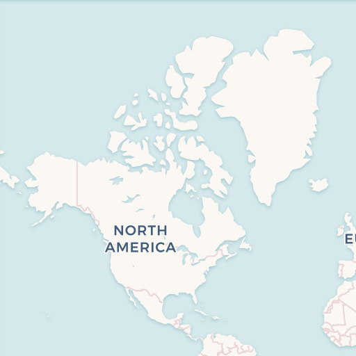
Main files
- [eastern-zone.pbf] - for osm2pgsql, Osmium, Osmosis, imposm, mkgmap, and others. This file was last modified -19 hours ago and contains all OSM data up to August 27 2025 15:15:09. File size: 199.4MB; MD5 sum: 31eb465fbc5463fe150a7c724346c6d5.
Additional Files
- [eastern-zone.poly] - file that describes the extent of this region. About POLY format
- [eastern-zone.geojson] - file that describes the extent of this region. About GeoJSON format


Prepared geodata of Eastern Zone
You are getting:
- Fresh geo data from the Openstreetmap project in ESRI Shape or Geopackage format
- If necessary, we can provide data in the following formats: GeoJSON, CSV, TAB
- Ready-made project for the QGIS 3 mapping program
- Styles for all layers
- 150+ icons
Samples of maps


Eastern Zone map layers
Fields of layer:
- osm_id — ID in OSM base
- name — Local name
- name_en — Name in English
- religion — religion field value
- amenity — amenity field value
- landuse — landuse field value
- leisure — leisure field value
- sport — sport field value
- type — type field value
- way — Geometry
Fields of layer:
- osm_id — ID in OSM base
- name — Local name
- name_en — Name in English
- religion — religion field value
- amenity — amenity field value
- landuse — landuse field value
- leisure — leisure field value
- sport — sport field value
- type — type field value
- way — Geometry
Fields of layer:
- osm_id — ID in OSM base
- barrier — barrier field value
- way — Geometry
Fields of layer: 
- osm_id — ID in OSM base
- name — Local name
- name_en — Name in English
- admin_level - Grade of administrative level
- way — Geometry
Fields of layer: 
- osm_id — ID in OSM base
- name — Local name
- name_en — Name in English
- admin_level - Grade of administrative level
- way — Geometry
Fields of layer:
- osm_id — ID in OSM base
- name — Local name
- name_en — Name in English
- building — building field value
- b_level — building:levels field value
- a_numb — addr:housenumber field value
- way — Geometry
Fields of layer:
- osm_id — ID in OSM base
- name — Local name
- name_en — Name in English
- building — building field value
- b_level — building:levels field value
- a_numb — addr:housenumber field value
- way — Geometry
Fields of layer:
- osm_id — ID in OSM base
- name — Local name
- name_en — Name in English
- natural — Natural field value
- landuse — Landuse field value
- wood — Wood field is not null
- leisure — Leisure field value
- way — Geometry
Fields of layer:
- osm_id — ID in OSM base
- name — Local name
- name_en — Name in English
- leisure — leisure field value
- way — Geometry
Fields of layer:
- osm_id — ID in OSM base
- name — Local name
- name_en — Name in English
- leisure — leisure field value
- way — Geometry
Fields of layer:
- osm_id — ID in OSM base
- name — Local name
- man_made — man_made field valu
- tower_type — tower:type field value
- way — Geometry
Fields of layer:
- osm_id — ID in OSM base
- name — Local name
- natural — natural field value
- way — Geometry
Fields of layer:
- osm_id — ID in OSM base
- name — Local name
- name_en — Name in English
- AMENITY — AMENITY field value
- way — Geometry
Fields of layer:
- osm_id — ID in OSM base
- name — Local name
- name_en — Name in English
- AMENITY — AMENITY field value
- way — Geometry
Fields of layer:
- osm_id — ID in OSM base
- name — Local name
- name_en — Name in English
- place — place field value
- official_s — official_status field value
- POPULATION — POPULATION field value
- way — Geometry
Fields of layer:
- osm_id — ID in OSM base
- name — Local name
- name_en — Name in English
- place — place field value
- official_s — official_status field value
- POPULATION — POPULATION field value
- is_capital — is_capital field value
- admin_level — Administrative grade value
- capital — capital field value
- way — Geometry
Fields of layer:
- osm_id — ID in OSM base
- name — Local name
- POWER — POWER field value
- VOLTAGE — VOLTAGE field value
- way — Geometry
Fields of layer:
- osm_id — ID in OSM base
- name — Local name
- POWER — POWER field value
- VOLTAGE — VOLTAGE field value
- way — Geometry
Fields of layer:
- osm_id — ID in OSM base
- name — Local name
- name_en — Name in English
- RAILWAY — RAILWAY field value
- way — Geometry
Fields of layer:
- osm_id — ID in OSM base
- name — Local name
- name_en — Name in English
- RAILWAY — RAILWAY field value
- traction — traction field value
- service — service field value
- BRIDGE — BRIDGE field value
- TUNNEL — TUNNEL field value
- way — Geometry
Fields of layer: 
- osm_id — ID in OSM base
- name — Local name
- name_en — Name in English
- RAILWAY — RAILWAY field value
- public_transport — public_transport field value
- tram — tram field value
- station — station field value
- way — Geometry
Fields of layer:
- osm_id — ID in OSM base
- name — Local name
- name_en — Name in English
- religion — religion field value
- way — Geometry
Fields of layer:
- osm_id — ID in OSM base
- name — Local name
- name_en — Name in English
- religion — religion field value
- way — Geometry
Fields of layer:
- osm_id — ID in OSM base
- name — Local name
- name_en — Name in English
- ref — ref field value
- HIGHWAY — HIGHWAY field value
- way — Geometry
Fields of layer:
- osm_id — ID in OSM base
- name — Local name
- name_en — Name in English
- ref — ref field value
- HIGHWAY — HIGHWAY field value
- cycle — cycle field value
- horse — horse field value
- foot — foot field value
- lanes — lanes field value
- toll — toll field value
- width — width field value
- way — Geometry
Fields of layer:
- osm_id — ID in OSM base
- name — Local name
- name_en — Name in English
- HIGHWAY — HIGHWAY field value
- railway — railway field value
- way — Geometry
Fields of layer:
- osm_id — ID in OSM base
- name — Local name
- name_en — Name in English
- shop — shop field value
- way — Geometry
Fields of layer:
- osm_id — ID in OSM base
- name — Local name
- name_en — Name in English
- shop — shop field value
- way — Geometry
Fields of layer:
- osm_id — ID in OSM base
- name — Local name
- name_en — Name in English
- sport — sport field value
- way — Geometry
Fields of layer:
- osm_id — ID in OSM base
- name — Local name
- name_en — Name in English
- sport — sport field value
- way — Geometry
Fields of layer:
- osm_id — ID in OSM base
- name — Local name
- name_en — Name in English
- TOURISM — TOURISM field value
- information — information field value
- historic — historic field value
- way — Geometry
Fields of layer:
- osm_id — ID in OSM base
- name — Local name
- name_en — Name in English
- TOURISM — TOURISM field value
- information — information field value
- historic — historic field value
- way — Geometry
Fields of layer:
- osm_id — ID in OSM base
- name — Local name
- name_en — Name in English
- ROUTE — ROUTE field value
- REF — REF field value
- OPERATOR — OPERATOR field value
- way — Geometry
Fields of layer:
- osm_id — ID in OSM base
- name — Local name
- name_en — Name in English
- WATERWAY — WATERWAY field value
- way — Geometry
Fields of layer:
- osm_id — ID in OSM base
- name — Local name
- name_en — Name in English
- natural — Natural field value
- landuse — Landuse field value
- water — Water field is not null
- waterway — Waterway field value
- way — Geometry
Fields of layer:
- id — Local ID
Fields of layer:
- id — Local ID
Fields of layer:
- id — Local ID
Legend of map of Eastern Zone and sample project


Statistics on objects in the Eastern Zone
| Name | Type | OSM Tag | Count |
| Countries | lines | admin_level = '2' | 565 |
| Administrative level 3 | lines | admin_level = '3' | 16 |
| Administrative level 4 | lines | admin_level = '4' | 775 |
| Administrative level 5 | lines | admin_level = '5' | 2104 |
| Administrative level 6 | lines | admin_level = '6' | 2875 |
| Administrative level 8 | lines | admin_level = '8' | 395 |
| Administrative level 9 | lines | admin_level = '9' | 1261 |
| Administrative level 10 | lines | admin_level = '10' | 198 |
| Name | Type | OSM Tag | Count |
| Countries | polygons | admin_level = '2' | 1 |
| Administrative level 4 | polygons | admin_level = '4' | 18 |
| Administrative level 5 | polygons | admin_level = '5' | 217 |
| Administrative level 6 | polygons | admin_level = '6' | 1706 |
| Administrative level 8 | polygons | admin_level = '8' | 14 |
| Administrative level 9 | polygons | admin_level = '9' | 1113 |
| Administrative level 10 | polygons | admin_level = '10' | 150 |
| Places | polygons | place = 'city' / place = 'town' / place = 'village' / place = 'hamlet' / place = 'locality' / place = 'suburb' / place = 'island' / place = 'farm' / place = 'isolated_dwelling' | 884 |
| Name | Type | OSM Tag | Count |
| City | polygons | place = 'city' | 31 |
| Town | polygons | place = 'town' | 54 |
| Village | polygons | place = 'village' | 569 |
| Hamlet | polygons | place = 'hamlet' | 56 |
| Locality | polygons | place = 'locality' | 14 |
| Suburb | polygons | place = 'suburb' | 6 |
| Island | polygons | place = 'island' | 103 |
| Isolated dwelling | polygons | place = 'isolated_dwelling' | 51 |
| Name | Type | OSM Tag | Count |
| Building | points | building is not '' | 389 |
| Name | Type | OSM Tag | Count |
| Building | polygons | building is not '' | 1767946 |
| Dominants | polygons | building = 'church' / building = 'government' / building = 'cathedral' / building = 'public' / building = 'hospital' / building = 'train_station' / building = 'chapel' / building = 'college' / building = 'university' | 778 |
| Schools and kindergartens | polygons | building = 'school' / building = 'kindergarten' | 679 |
| Under construction | polygons | building = 'construction' | 250 |
| Name | Type | OSM Tag | Count |
| bicycle parking | points | amenity = 'bicycle_parking' | 49 |
| police | points | amenity = 'police' | 160 |
| fire station | points | amenity = 'fire_station' | 24 |
| post box | points | amenity = 'post_box' | 13 |
| post office | points | amenity = 'post_office' | 133 |
| telephone | points | amenity = 'telephone' | 3 |
| library | points | amenity = 'library' | 42 |
| townhall | points | amenity = 'townhall' | 20 |
| courthouse | points | amenity = 'courthouse' | 14 |
| prison | points | amenity = 'prison' | 6 |
| embassy | points | amenity = 'embassy' / office = 'diplomatic' | 10 |
| community centre | points | amenity = 'community_centre' | 38 |
| nursing home | points | amenity = 'nursing_home' | 4 |
| arts centre | points | amenity = 'arts_centre' | 2 |
| cemetery | points | amenity = 'grave_yard' / landuse = 'cemetery' | 11 |
| marketplace | points | amenity = 'marketplace' | 109 |
| university | points | amenity = 'university' | 29 |
| school | points | amenity = 'school' | 525 |
| kindergarten | points | amenity = 'kindergarten' | 5 |
| college | points | amenity = 'college' | 125 |
| pharmacy | points | amenity = 'pharmacy' | 214 |
| hospital | points | amenity = 'hospital' | 3238 |
| clinic | points | amenity = 'clinic' | 1783 |
| doctors | points | amenity = 'doctors' | 326 |
| dentist | points | amenity = 'dentist' | 379 |
| veterinary | points | amenity = 'veterinary' | 4 |
| theatre | points | amenity = 'theatre' | 17 |
| nightclub | points | amenity = 'nightclub' | 5 |
| cinema | points | amenity = 'cinema' | 76 |
| swimming pool | points | amenity = 'swimming_pool' / leisure = 'swimming_pool' / sport = 'swimming' / leisure = 'water_park' | 11 |
| restaurant | points | amenity = 'restaurant' | 663 |
| fast food | points | amenity = 'fast_food' | 246 |
| cafe | points | amenity = 'cafe' | 199 |
| pub | points | amenity = 'pub' | 11 |
| bar, biergarten | points | amenity = 'bar' / amenity = 'biergarten' | 32 |
| food court | points | amenity = 'food_court' | 14 |
| shelter | points | amenity = 'shelter' | 14 |
| car rental | points | amenity = 'car_rental' | 6 |
| car wash | points | amenity = 'car_wash' | 7 |
| car sharing | points | amenity = 'car_sharing' | 1 |
| bicycle rental | points | amenity = 'bicycle_rental' | 2 |
| bank | points | amenity = 'bank' | 557 |
| atm | points | amenity = 'atm' | 517 |
| toilets | points | amenity = 'toilets' | 91 |
| bench | points | amenity = 'bench' | 222 |
| drinking water | points | amenity = 'drinking_water' | 103 |
| fuel | points | amenity = 'fuel' | 758 |
| bus station | points/polygons | amenity = 'bus_station' | 131 |
| taxi | points/polygons | amenity = 'taxi' | 20 |
| ferry terminal | points/polygons | amenity = 'ferry_terminal' | 110 |
| Name | Type | OSM Tag | Count |
| Christian churches | points | amenity = 'place_of_worship' + religion = 'christian' | 46 |
| Synagogue | points | amenity = 'place_of_worship' + religion = 'jewish' | 2 |
| Mosque | points | amenity = 'place_of_worship' + religion = 'muslim' | 100 |
| Buddhist temple | points | amenity = 'place_of_worship' + religion = 'buddhist' | 65 |
| Hindu temple | points | amenity = 'place_of_worship' + religion = 'hindu' | 993 |
| Sikh temple | points | amenity = 'place_of_worship' + religion = 'sikh' | 7 |
| Name | Type | OSM Tag | Count |
| fishing | points | leisure = 'fishing' | 1 |
| playground | points/polygons | leisure = 'playground' | 57 |
| sports centre | points/polygons | leisure = 'sports_centre' | 9 |
| stadium | points/polygons | leisure = 'stadium' | 12 |
| marina | points | leisure = 'marina' | 1 |
| slipway | points | leisure = 'slipway' | 4 |
| Name | Type | OSM Tag | Count |
| supermarket, general | points | shop = 'supermarket' / shop = 'general' | 187 |
| bakery | points | shop = 'bakery' | 49 |
| kiosk | points | shop = 'kiosk' | 32 |
| mall | points | shop = 'mall' | 51 |
| department store | points | shop = 'department_store' | 27 |
| convenience | points | shop = 'convenience' | 90 |
| clothes | points | shop = 'clothes' | 211 |
| florist | points | shop = 'florist' | 23 |
| chemist | points | shop = 'chemist' | 15 |
| books | points | shop = 'books' | 33 |
| butcher | points | shop = 'butcher' | 21 |
| shoes | points | shop = 'shoes' | 68 |
| alcohol, beverages | points | shop = 'alcohol' / shop = 'beverages' | 40 |
| optician | points | shop = 'optician' | 26 |
| jewelry | points | shop = 'jewelry' | 63 |
| gift | points | shop = 'gift' | 41 |
| sports | points | shop = 'sports' | 6 |
| stationery | points | shop = 'stationery' | 35 |
| outdoor | points | shop = 'outdoor' | 5 |
| mobile phone | points | shop = 'mobile_phone' | 54 |
| toys | points | shop = 'toys' | 5 |
| newsagent | points | shop = 'newsagent' | 1 |
| greengrocer | points | shop = 'greengrocer' | 38 |
| beauty | points | shop = 'beauty' | 28 |
| video | points | shop = 'video' | 3 |
| car | points | shop = 'car' | 40 |
| bicycle | points | shop = 'bicycle' | 15 |
| doityourself, hardwar | points | shop = 'doityourself' / shop = 'hardware' | 51 |
| furniture | points | shop = 'furniture' | 43 |
| computer | points | shop = 'computer' | 36 |
| garden centre | points | shop = 'garden_centre' | 3 |
| hairdresser | points | shop = 'hairdresser' | 52 |
| car repair | points | shop = 'car_repair' | 19 |
| Name | Type | OSM Tag | Count |
| basketball | points | sport = 'basketball' | 3 |
| fitness | points | sport = 'fitness' | 3 |
| motor | points | sport = 'motor' | 1 |
| soccer | points | sport = 'soccer' | 5 |
| swimming | points | sport = 'swimming' | 4 |
| table tennis | points | sport = 'table_tennis' | 10 |
| tennis | points | sport = 'tennis' | 1 |
| volleyball | points | sport = 'volleyball' | 1 |
| Name | Type | OSM Tag | Count |
| artwork | points/polygons | tourism = 'artwork' | 107 |
| attraction | points/polygons | tourism = 'attraction' | 149 |
| camp site | points/polygons | tourism = 'camp_site' | 7 |
| caravan site | points/polygons | tourism = 'caravan_site' | 2 |
| guest house | points/polygons | tourism = 'guest_house' | 205 |
| hostel | points/polygons | tourism = 'hostel' | 89 |
| hotel | points | tourism = 'hotel' | 503 |
| information | points/polygons | tourism = 'information' | 37 |
| motel | points/polygons | tourism = 'motel' | 11 |
| museum | points/polygons | tourism = 'museum' | 45 |
| picnic site | points | tourism = 'picnic_site' | 4 |
| theme park | points/polygons | tourism = 'theme_park' | 4 |
| viewpoint | points | tourism = 'viewpoint' | 50 |
| zoo | points/polygons | tourism = 'zoo' | 9 |
| yes | points | tourism = 'yes' | 3 |
| alpine hut | points | tourism = 'alpine_hut' | 7 |
| map | points | information = 'map' | 1 |
| board | points | information = 'board' | 1 |
| monument | points | historic = 'monument' | 37 |
| memorial | points | historic = 'memorial' | 53 |
| apartment | points | tourism = 'apartment' | 112 |
| gallery | points | tourism = 'gallery' | 1 |
| wilderness hut | points | tourism = 'wilderness_hut' | 1 |
| Name | Type | OSM Tag | Count |
| Coastlines | lines | 1 | |
| Water surface | polygons | 1 | |
| Land boundaries | polygons | 1 |
| Name | Type | OSM Tag | Count |
| Lakes and large rivers | polygons | natural = 'water' / waterway = 'riverbank' | 49236 |
| Wetland | polygons | natural = 'wetland' | 1942 |
| water' and water not | polygons | natural = 'water' + water is not 'river' + water is not 'reservoir' | 27505 |
| Name | Type | OSM Tag | Count |
| Canal | lines | waterway = 'canal' | 4594 |
| Drain | lines | waterway = 'drain' | 951 |
| River | lines | waterway = 'river' | 5406 |
| Stream | lines | waterway = 'stream' | 6535 |
| Others | lines | waterway is not '' | 21342 |
| Name | Type | OSM Tag | Count |
| Fence | lines | barrier = 'fence' | 677 |
| Wall | lines | barrier = 'wall' | 2040 |
| Name | Type | OSM Tag | Count |
| Tower | points | man_made = 'tower' | 315 |
| Cell tower | points | man_made = 'tower' + tower:type = 'communication' | 106 |
| Water tower | points | man_made = 'water_tower' | 181 |
| Lookout tower | points | man_made = 'tower' + tower:type = 'observation' | 11 |
| Lighthouse | points | man_made = 'lighthouse' | 9 |
| Water well | points | man_made = 'water_well' | 52 |
| Watermill | points | man_made = 'watermill' | 1 |
| Name | Type | OSM Tag | Count |
| Power lines | lines | power is not '' | 3291 |
| Name | Type | OSM Tag | Count |
| Towers Power lines | points | power is not '' | 167965 |
| Name | Type | OSM Tag | Count |
| Spring | points | natural = 'spring' | 13 |
| Peak | points | natural = 'peak' | 817 |
| Tree | points | natural = 'tree' | 4003 |
| Cave entrance | points | natural = 'cave_entrance' | 11 |
| Name | Type | OSM Tag | Count |
| City | points | place = 'city' | 99 |
| Town | points | place = 'town' | 516 |
| Village | points | place = 'village' | 6300 |
| Hamlet | points | place = 'hamlet' | 6859 |
| Hamlet | points | place = 'locality' | 301 |
| Name | Type | OSM Tag | Count |
| Allotments | polygons | landuse = 'allotments' | 4 |
| Basin | polygons | landuse = 'basin' | 677 |
| Brownfield | polygons | landuse = 'brownfield' | 13 |
| Cemetery | polygons | landuse = 'cemetery' | 56 |
| Commercial | polygons | landuse = 'commercial' | 422 |
| Construction | polygons | landuse = 'construction' | 61 |
| Farm, farmland | polygons | landuse = 'farm' / landuse = 'farmland' | 16109 |
| Farmyard | polygons | landuse = 'farmyard' | 308 |
| Forest | polygons | landuse = 'forest' / landuse = 'natural' | 1386 |
| Garages | polygons | landuse = 'garages' | 6 |
| Grass | polygons | landuse = 'grass' | 891 |
| Greenfield | polygons | landuse = 'greenfield' | 34 |
| Industrial | polygons | landuse = 'industrial' | 2851 |
| Landfill | polygons | landuse = 'landfill' | 69 |
| Meadow | polygons | landuse = 'meadow' | 178 |
| Quarry | polygons | landuse = 'quarry' | 1824 |
| Railway | polygons | landuse = 'railway' | 207 |
| Recreation ground | polygons | landuse = 'recreation_ground' | 485 |
| Reservoir | polygons | landuse = 'reservoir' | 1277 |
| Residential | polygons | landuse = 'residential' | 37223 |
| Retail | polygons | landuse = 'retail' | 223 |
| Salt pond | polygons | landuse = 'salt_pond' | 2 |
| Village green | polygons | landuse = 'village_green' | 19 |
| Plant nursery | polygons | landuse = 'plant_nursery' | 7 |
| Education | polygons | landuse = 'education' | 8 |
| Park | polygons | leisure = 'park' | 2535 |
| Beach | polygons | natural = 'beach' | 45 |
| Fell | polygons | natural = 'fell' | 2 |
| Grassland | polygons | natural = 'grassland' | 722 |
| Heath | polygons | natural = 'heath' | 112 |
| Sand | polygons | natural = 'sand' | 254 |
| Scrub | polygons | natural = 'scrub' | 2536 |
| Name | Type | OSM Tag | Count |
| Amenity | polygons | amenity is not '' | 5033 |
| Name | Type | OSM Tag | Count |
| Leisure | polygons | leisure is not '' | 4816 |
| Name | Type | OSM Tag | Count |
| Place of worship | polygons | amenity = 'place_of_worship' | 1663 |
| Place of worship | polygons | amenity = 'place_of_worship' | 1663 |
| Name | Type | OSM Tag | Count |
| Shop | polygons | shop is not '' | 561 |
| Name | Type | OSM Tag | Count |
| Sport | polygons | sport is not '' | 692 |
| Name | Type | OSM Tag | Count |
| Tourism | polygons | tourism is not '' | 615 |
| Name | Type | OSM Tag | Count |
| parking | polygons | amenity = 'parking' | 236 |
| Name | Type | OSM Tag | Count |
| bus, tram, trolleybus | lines | route = 'bus' / route = 'trolleybus' / route = 'tram' / route = 'share_taxi' | 521 |
| subway | lines | route = 'subway' | 6 |
| train | lines | route = 'train' | 202 |
| ferry | lines | route = 'ferry' | 121 |
| Name | Type | OSM Tag | Count |
| Platform | polygons | railway = 'platform' | 823 |
| Name | Type | OSM Tag | Count |
| Abandoned | lines | railway = 'abandoned' | 458 |
| Construction | lines | railway = 'construction' | 623 |
| Narrow gauge | lines | railway = 'narrow_gauge' | 169 |
| Platform | lines | railway = 'platform' | 488 |
| Railway | lines | railway = 'rail' + service is null | 10438 |
| Service railway | lines | railway = 'rail' + service is not null | 8531 |
| Subway | lines | railway = 'subway' | 159 |
| tram | lines | railway = 'tram' | 170 |
| funicular | lines | railway = 'funicular' / railway = 'rail' + traction = 'funicular' | 1 |
| Name | Type | OSM Tag | Count |
| Trunk | lines | highway = 'trunk' / highway = 'trunk_link' | 13262 |
| Primary | lines | highway = 'primary' / highway = 'primary_link' | 8190 |
| Secondary | lines | highway = 'secondary' / highway = 'secondary_link' | 13687 |
| Tertiary | lines | highway = 'tertiary' / highway = 'tertiary_link' | 34679 |
| Unclassified | lines | highway = 'unclassified' | 149630 |
| Residential | lines | highway = 'residential' | 990840 |
| Service | lines | highway = 'service' | 94923 |
| Footway | lines | highway = 'footway' / highway = 'path' + foot = 'designated' | 4702 |
| Construction | lines | highway = 'construction' | 921 |
| Road | lines | highway = 'road' | 2068 |
| Cycleway | lines | highway = 'cycleway' / highway = 'path' + cycle = 'designated' | 128 |
| Living street | lines | highway = 'living_street' | 8452 |
| Pedestrian | lines | highway = 'pedestrian' | 215 |
| Steps | lines | highway = 'steps' | 1266 |
| Track | lines | highway = 'track' | 57461 |
| Bridleway | lines | highway = 'bridleway' / highway = 'path' + horse = 'designated' | 4 |
| Raceway | lines | highway = 'raceway' | 1 |
| Name | Type | OSM Tag | Count |
| Crossing | points | highway = 'crossing' / railway = 'level_crossing' | 17883 |
| Traffic signals | points | highway = 'traffic_signals' | 147 |
| Mini roundabout | points | highway = 'mini_roundabout' | 45 |
| Stop | points | highway = 'stop' | 21 |
| Street lamp | points | highway = 'street_lamp' | 626 |
| Bus stop | points | highway = 'bus_stop' | 791 |
| Name | Type | OSM Tag | Count |
| services | polygons | highway = 'services' | 4 |
| Name | Type | OSM Tag | Count |
| square | polygons | place = 'square' | 12 |
![.$row2[6].](/img/Squere.webp)
| Name | Type | OSM Tag | Count |
| Station | points | railway = 'station' | 1808 |
| Halt | points | railway = 'halt' | 242 |
| Tram stop | points | railway = 'tram_stop' / public_transport = 'stop_position' + tram = 'yes' | 40 |
| Subway entrance | points | railway = 'subway_entrance' | 24 |
This site is not affiliated with OpenStreetMap Foundaton and is an independent project providing data based on OSM. The data corresponds to the original OSM data, the cutting into geographical areas may differ from the boundaries contained in OSM. OpenStreetMap data is distributed under the ODbL license.